%20V1.png)
Snapshot
Status: Exploration
Location: Alaska, USA
Ownership: 100%
Metals: Gold
Royalty: 4.5%

Overview
The Unga Project is in the Aleutian Islands in Alaska. The land package hosts three different epithermal vein system trends. Drill results from all three projects have returned high grade gold and silver occurrences.
Despite being mined in the early1900s, the property had never seen modern, systematic exploration prior to Heliostar's ownership. Field exploration by the company found six other unexplored targets, outside of the three advanced locations.
History
Gold was first discovered on Unga Island in 1881. The Apollo gold mine operated until the 1920s and produced~130,000 oz of gold from the upper, oxidized portions of the orebody.
Modern exploration started in1974 with mapping, geophysical surveys and some limited drilling across thearea through the next decade by Battle Mountain Gold and Alaska Apollo GoldMines Ltd. A number of feasibility studies were conducted from 1987 to 1996before the project was left idle.
Aquila was identified as a target in the 1980’s. with trenching returning outcropping gold in epithermal veins. The best result was 11.48 g/t gold and 53.47 g/t silver over 3.66m. However, little core was recovered in the subsequent drill program causing the target to idle until 2020.
Redstar Gold acquired the properties in 2013.


Location and Infrastructure
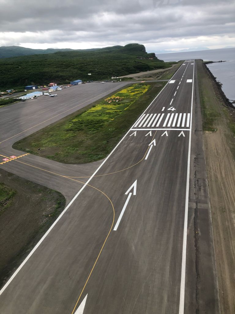
The project is located on the Alutian Island chain archipelago in Alaska. While remote, the project does have the benefit of nearby infrastructure. The town of Sand Point (population ~600) is within 10kmof Unga Island and within 4km of the Centennial property. The town hosts an airport with daily flights to Anchorage, twice monthly service from the Alaska Marine Highway System, harbour infrastructure, a small power utility and a community health center.

Resources & Reserves

Overview
The Unga Project is in the Aleutian Islands in Alaska. The land package hosts three different epithermal vein system trends. Drill results from all three projects have returned high grade gold and silver occurrences.
Despite being mined in the early1900s, the property had never seen modern, systematic exploration prior to Heliostar's ownership. Field exploration by the company found six other unexplored targets, outside of the three advanced locations.
History
Gold was first discovered on Unga Island in 1881. The Apollo gold mine operated until the 1920s and produced~130,000 oz of gold from the upper, oxidized portions of the orebody.
Modern exploration started in1974 with mapping, geophysical surveys and some limited drilling across thearea through the next decade by Battle Mountain Gold and Alaska Apollo GoldMines Ltd. A number of feasibility studies were conducted from 1987 to 1996before the project was left idle.
Aquila was identified as a target in the 1980’s. with trenching returning outcropping gold in epithermal veins. The best result was 11.48 g/t gold and 53.47 g/t silver over 3.66m. However, little core was recovered in the subsequent drill program causing the target to idle until 2020.
Redstar Gold acquired the properties in 2013.
Location and Infrastructure
The project is located on the Alutian Island chain archipelago in Alaska. While remote, the project does have the benefit of nearby infrastructure. The town of Sand Point (population ~600) is within 10kmof Unga Island and within 4km of the Centennial property. The town hosts an airport with daily flights to Anchorage, twice monthly service from the Alaska Marine Highway System, harbour infrastructure, a small power utility and a community health center.
Resources & Reserves
Geology
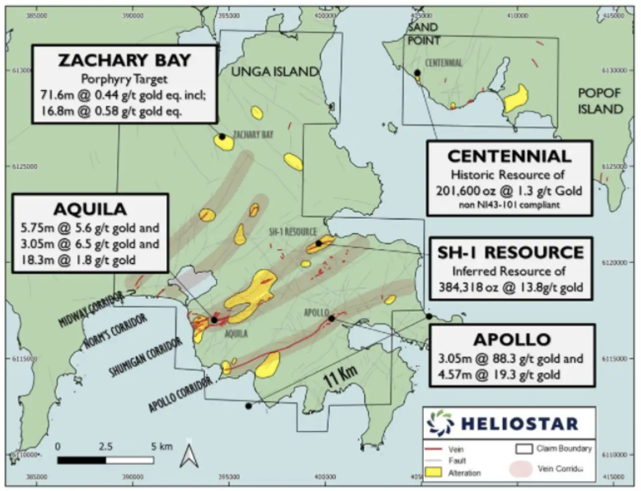
The Shumagin and Apollo-Sitka trends have been the focus of exploration with multiple targets identifed along them. These include:
- SH-1 – Shumigan Trend
- Aquila - Shumigan Trend
- Apollo-Sitka – Apollo Trend
- Centennial
- Zachary Bay porphyry gold-copper
Gold mineralization at the Centennial Zone is located on neighbouring Popof Island within four kilometres of infrastructure and services at Sand Point.
SH-1
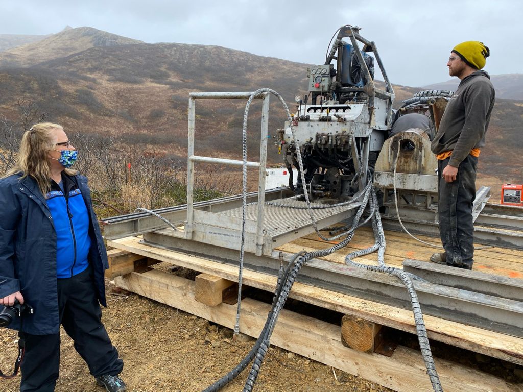
SH-1 holds a high-grade, inferred resource of 384,318 ounce sat 13.8 g/t and is open both laterally and at depth. The deepest drilling done to date has returned multiple >10 g/t hits outside of the current resource envelope. Heliostar's drill program has helped the team better understand and define the geologic controls on the high-grade shoots, leading to exploration success at the Main Shoot.
The deepest completed hole to date at SH-1 intersected 23.99g/t gold over 5.48 metres in hole BM-01 providing a quality target for additional follow up.
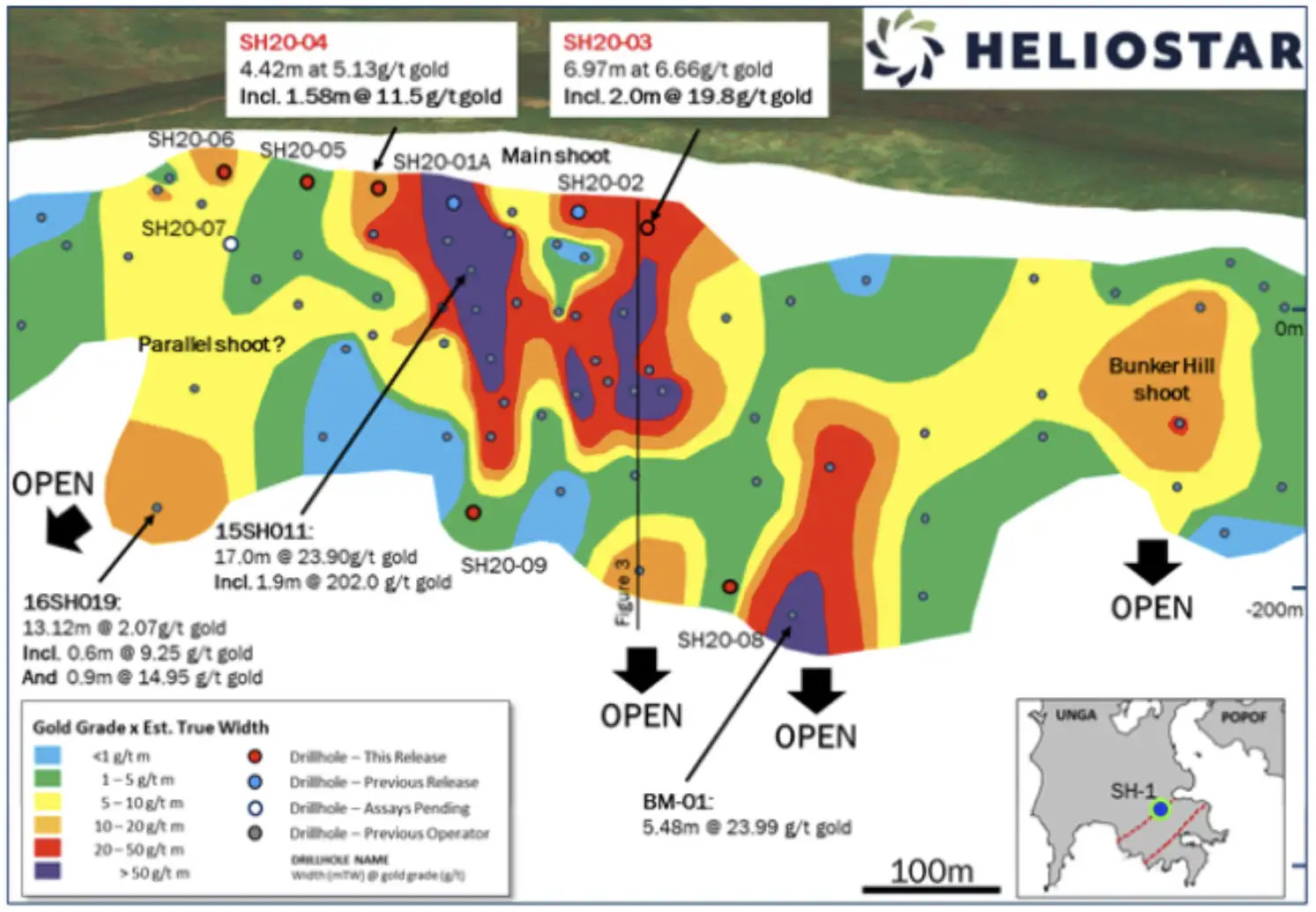
At SH-1, the vein occurs at the contact of the rhyolites to the southeast and andesites to the northwest. This mineralized structure is comprised a core of competent, brecciated quartz that grades outwards through quartz alteration into the host rock. The mineralization is associated with the zinc and lead sulphides, sphalerite and galena.
Aquila
Aquila sits six kilometers south of SH-1 on the same Shumigan Trend. Heliostar’s first drill hole of a five-hole program in 2020 hit31.55m of 1.80 g/t and 17.37m of 2.24 g/t. This result showing a wide, shallow zone of gold mineralization opened an entirely new area for exploration.
In 2021, Heliostar drilled thirteen RC holes, all of which intersected the Amethyst Vein. This extended the definition of this structure along a strike length of 475 metres. with five holes defining a zone of continuous mineralization 120 metres long. Two separate zones within this vein contain higher-grade gold mineralization, both of which are open at depth. The deepest hole drilled at Aquila only extends to 150m below surface. In addition, surface samples returned grades up to 30.8 g/t gold to the northeast in an area that has yet to be drill tested.

The Aquila Target is comprised of outcropping, epithermal quartz veins with exploration to date near the top of the mineralized system. The geological evidence of this is a high gold to silver ratio, high precious metals to base metal ratio, relative elevation of Aquila to SH-1 and Apollo and specific quartz textures observed within the veins all indicating a shallow level within the system.
Drilling shows gold mineralization becomes thicker to the northeast, indicating that the system may be becoming more robust in that direction. This area is a major intersection of northeast striking Shumagin Vein Corridor and several east-west striking veins, with high potential for gold rich shoots given the structural preparation.
Apollo/Sitka
Apollo was Alaska's first underground mine, with ore mined from three parallel veins with three different shaft accesses - Apollo #1  and Sitka. The miners at the time only exploited the upper, oxidized portions of the orebody. They stopped when they encountered primary sulphides as the now industry standard floatation and CIL processing method had yet to be invented. Historic reports note that many drifts and crosscuts encountered veins with gold, silver, and base metals which were not followed up with drill testing. This represents a large opportunity for modern exploration.

A combination of diamond and RC drilling done by Heliostar has confirmed the location of the main gold bearing structure at depth and across a fault offset. Step out drilling extended the strike of known mineralization at both the Shaft #2 and Sitka areas with drilling down dip at Sitka extending mineralization 40m vertically and proving the deposit remains open at depth. This drilling also encountered multiple sub-parallel veins proximal to the previously mined structures.
Veining is composed of quartz with minor clay and variable amounts of sphalerite, galena and chalcopyrite. Visible gold (VG) has been seen in RC chips. Mineralization varies from gold-dominant to base metal-dominant and appears to change rapidly over short intervals.

Zachary Bay
Zachary Bay is a porphyry target that sits ~5km north of the SH-1 resource. It was identified by mapped outcropping mineralization and round magnetics survey. The target was confirmed by a single drill hole done by a previous owner in 1975. This hole returned mineralization along its entire 117mlength including 0.28 g/t gold and 0.11 % copper over 107.1 metres with individual gold values up to 0.95 g/t. The magnetics show a sizeable core of the anomaly (300m x 650m) with typical porphyry alteration (propylitic, argillic and advanced argillic) extending ~50% further afield.


In 2021, Heliostar completed two RC holes targeting the porphyry style mineralization. The first hole was designed to collect additional data near the previously drilled hole from 1975 and hit 118.9 m of0.15 g/t gold and 0.15% copper over its entire lenght once through the thin overburden. Within this zone intervals of higher grade include 16.76 m at0.58 g/t gold equivalent, with individual assays up to 0.42 g/t gold and 0.3 %copper.
The second was 108m to the northeast of the historic hole, at the edge of the magnetic high. The entire of this hole also contained gold and copper mineralization from surface to the end of hole at a depth of 100.6mgrading 0.19 g/t gold and 0.09 % copper. Mineralization increased towards the end the of the hole which terminated in 3.05 m of 0.41 g/t gold and 0.14%copper. Management sees this as a clear opportunity for follow-up drilling to better define this higher-grade zone.
Table of significant intersections from the Zachary Bay target:

Centennial Gold Deposit
The Centennial deposit sits about 4km south of Sand Point on Popof Island. First mined on a small scale as a 'difficult' placer deposit in the early 1900s, it was largely unexplored until the 1980s. Gold mineralization at that time was focused on a 1,200m long by 600m wide in a flat-lying, out cropping dacite tuff containing fine, free-gold. The target hosts a historic resource of 201,600 oz at 1.3 g/t within this zone to a maximum depth of ~80m.
However, a drone IP survey done by Heliostar identified a complex of vertical structures that could form feeder zones. These gold bearing-hydrothermal structures can be seen in the cliffs and have been mapped by crews on the ground. Vertical drilling done by previous owners targeting the flat-lying deposit meant that these high angle portions of the system were largely missed. This provides a 'low-hanging fruit' opportunity at the project.


1 The reader is cautioned that the qualified person has not been able to independently verify the historical assay results presented above. Heliostar’s drilling as been designed to establish the grades and widths of vein targets on the property.


Project News